The Mystery Of The Pre-Placed Orange Car By The Drainage Pipes: East Palestine Train Crash Investigation
What was this car doing at the site of the crash? Why did it catch fire like this?!
This article has been made into a movie: watch now
The first cars left after the train crash were strewn at approximately lat/lon coordinates 40.836509, -80.521309, right in front of the Sulfur Run reservoir. This is very suspicious as Sulfur Run feeds into Leslie Run, which passes into Little Beaver Creek and then into the Ohio River where it flows into the Mississippi river and then into the Gulf of Mexico near New Orleans
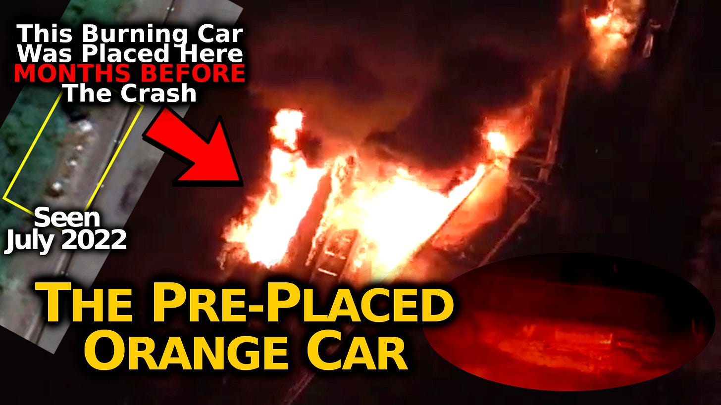
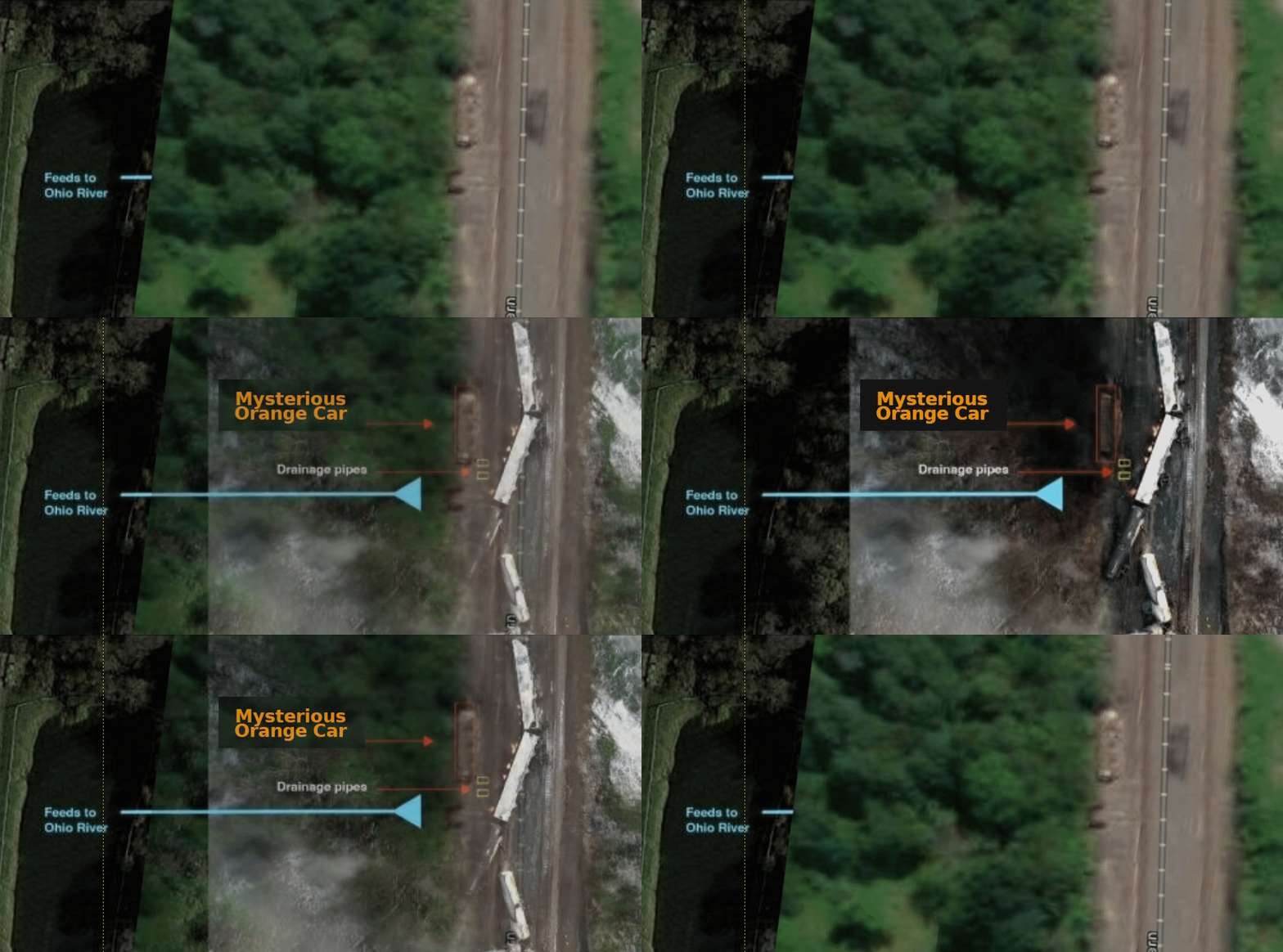
Between the first cars left after the crash and the Sulfur Creek waterway is a mysterious orange car. This car can be seen in archived satellite images going back more than half a year. Suspiciously, the orange railcar can also be seen burning ITSELF, seemingly burning separate from the other blaze.
Archived Satellite Images From World Imagery Wayback
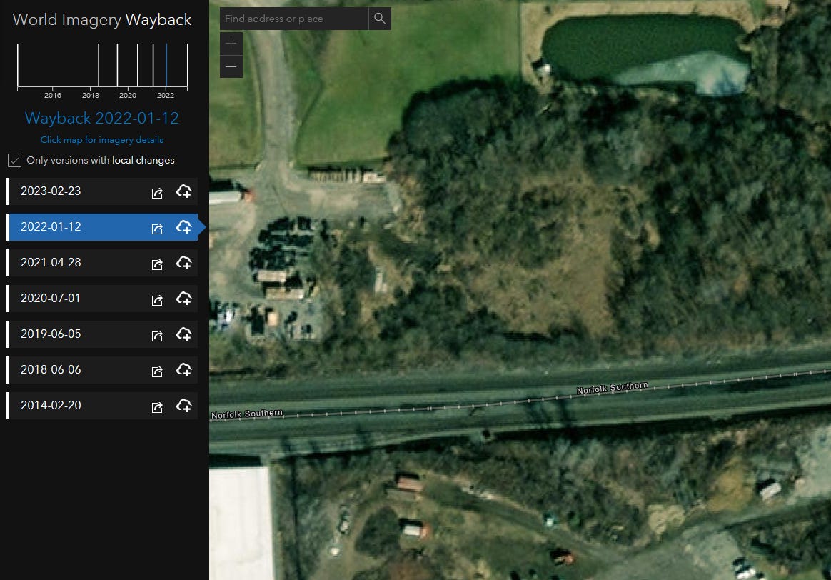
Our first source of archived satellite images is: https://livingatlas.arcgis.com/wayback/#active=42663&ext=-80.52374,40.83521,-80.51953,40.83723&localChangesOnly=true
There are two interesting snapshots: a shot dated January 12th 2022 WITHOUT the orange car & a snapshot WITH the orange car present from BEFORE the crash incorrectly dated Febrary 23rd 2023.
Satellite Snapshot Dated January 12th 2022
No car can be seen in this photo alongside the tracks where the crash would take place about a year later.
Pre-Crash Satellite Snapshot Incorrectly Dated February 23th 2023
The archive’s date of February 23rd 2023 of this next photo is incorrect as I will explain below. It seems this was actually sometime BEFORE the crash
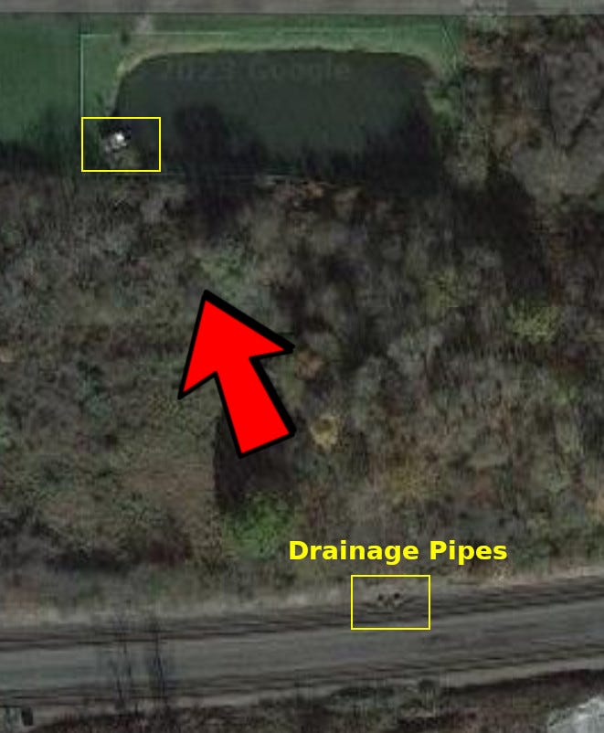
This matches exactly with the car nearby the tragic crash:
I think the date attributed to this photo in the archive is incorrect. For reference, here is a photo of the cleanup taken by Eric’s Train Yard sometime between the 16th-18th of February 2023:
We can’t see the drainage pipes in Eric’s shot but we can compare the same region from the database
As evidenced by the lack of crash or explosion damage/ cleanup efforts, the date given in the archive satellite photos is incorrect and this was actually sometime BEFORE the crash. This would mean that the car was placed there well in advance of the derailment & explosion.
The arcgis.com webpage gives some more info about this image set. Apparently the dates mean “as of” and not the actual dates the photos were taken:
“This Metadata layer, and the associated Wayback imagery layer, represent a version of World Imagery content as of 2023-02-23.”
Google Earth Satellite Image Archive
Likewise, we can get some chronological context to the mysterious orange car in the archive for Google Earth. The key dates that show the car are: July 2022
July 2022 Snapshot
Hold The 0nion’s Additional Research Findings:
I got this message under one of my videos:
I can’t verify this exactly but it matches what I’ve found and seems to be sourced to a difference archive as evidenced by the dates of the snapshots.
The Car Was Ablaze After The Crash
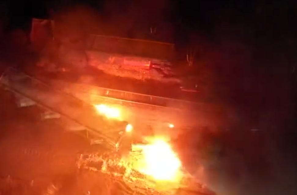
The largest part of the mystery is seen in at least one video: this orange car was filmed BURNING FIERCELY after the train wreck:
So a peculiarly placed car, right near the reservoir for Sulfur Run → Leslie Run → Little Beaver Creek → Ohio River → Mississippi River → Gulf of Mexico, mysteriously also CAUGHT FIRE?! And this was not a minor fire, you can see the roof of the car was blazing.
What was in this car and why was it placed right next to the waterway where the fateful crash would occur? Why would a car be sitting in this precise, precarious location? What was the accelerant that we see burning on the TOP of the car?! Why wasn’t it emptied of flammable material?
More Views Of The Car
There are surprisingly few photos and videos of this mysterious orange car from either before or after the crash.
Here is the best post-crash view of it I’ve been able to find from a local news crew’s drone shot on 2/6/2023:
Thanks to a timtruth@protonmail.com tipster we were able to locate some more pre-crash satellite photos of the orange car:






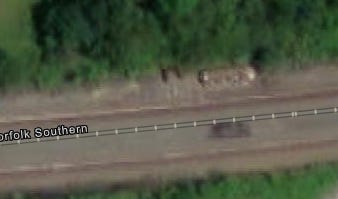

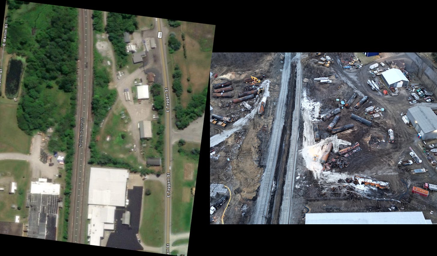




They used to have 3" & 6" resolution orthophotos available for download from the County's GIS website. Guess what - they're "no longer available".... https://columbiana-county-gis-data-columauditor.hub.arcgis.com/pages/downloads If you go to their interactive web map viewer and search for Parcel 67-00403 and zoom in really tight, it looks like they are using the leaf-off high-res orthos as a basemap, but it doesn't look quite detailed enough to be 3" or 6", unless they've purposely resampled it to be smaller file size & display speed for the web viewer... And I'm not seeing any metadata to show when they were flown. The car in question is not visible on the tracks at the location you are interested in. County orthos aren't typically flown every year, especially very high-res in a rural area, so this imagery could be 3-4 yrs old. In my state, they only fly every 4 yrs or so, when they are fixing to do property revaluations, unless it's a large & wealthy urban area.
We the village of Negley 3 miles down stream of E. Palestine, have been fighting the Government & OEPA / ODNR FOR 20 YEARS Permitting our village Drinking water 16- first order class 3 streams best in state, and 2 Aquifers Taken & Destroyed to permit a DUMP over the village ! Three years ago We discovered we had Ancient Indian Mounds & system in Negley ! The twice Documented Mound is Twice the size of Monks Mound Cahokia which is claimed to be the largest pre-Columbian earth work in North America, it is not ! The Governor of Ohio has been fighting us in ERAC - Environmental Review Appeals Commission for 4 terms ! Two terms as Attorney General for the oepa & dump and two terms as Governor of Ohio having his attorney general do the same, THEY DO NOT REPRESENT US ! ?
For the past 3 years the government as refused to acknowledge the Oldest, Largest, Paleo Indian Mounds and last remaining ancient advanced City not built over in North America , The Dump documents claimed no important Ancient archaeological sites ,within 3 miles of dump, yet our twice documented Mound documented in the 1914 archaeological atlas of Ohio as Adena ! I do not no if you noticed the Governor snicker on the news - when he said I'm getting out of here before they light the rail car bomb off ? This takes care of the World Heritage Site , and Negley's Drinking water fight , and the gov. can monitor how the poor folks of the area, handle the toxic barrage ! A win, win, Win, for the corrupted Criminal entity ! Lets not forget contaminating central North Americas Food belt to the gulf of Mexico ! MAYBE THIS HAS SOMETHING TO DO WITH THIS FREAK ACCIDENT ?